
It pains me to say I've had a rather disagreeable summer, with more things going wrong — hellishly and expensively so — in a short span of time than the law ought to allow. However, on the positive side, the geocaching this summer has been most satisfying, as I've managed to claim a number of old nemeses. A few weeks ago, I found "Pirates of the Seven Lakes," an aged but recently refurbished multi-stage cache that required hikes of varying degrees of difficulty on several different trails ("Pirates," August 11, 2015); last weekend, I picked up "Vanishing Point," which had been doing its best to drive me to excessive drinking ("Arch-Nemesis," September 13, 2015); and today, at least two years since finding its first few stages, I finally knocked out "Marsh-a, Marsh-a, Marsh-a" (GC18NT4), one of the few trail hides in Greensboro I had yet to claim. Marsh-a is the work of my frequent caching partner, "Bloody" Rob Isenhour, and his cohort, Sarah "Sssharkie" Stevens, though the cache been out there in the wild since before I even knew either of them.
As you might guess, Marsh-a is so named for the very dense, very wild marsh along Reedy Fork Creek, which connects Lakes Brandt and Townsend, just north of Greensboro. The first few stages are close to the Reedy Fork Trail, and while they're challenging enough in their own right, they don't really take you into the thick of it. That's reserved for last couple of stages, and the final, more often than not, is only accessible by boat or by swimming. Since I don't have the first item and am not overly keen on the second — at least in this environment — hunting that final stage has not been number one on the priority list. I had found the first few stages a couple of years ago, but at that time, the lake was high, so old Rodan ended up retreating in defeat. Recently, though, the lake levels have been very low, so today I decided to have another go at it. After hiding a new cache of my own on the nearby Blue Heron Trail, I made the lengthy hike out the Reedy Fork Trail, and — what do you know — reaching ground zero on foot looked more promising than it had on previous excursions.
Still — ye gods, what a monster! Though the water had receded, the reeds, briers, and brambles between the trail and ground zero looked ominous, almost impenetrable. But with the cache only 500-some feet away, there was nothing for it but to make my way into this darkest of marshy thickets. For about half the distance, I had to hack my way through grasses that rose higher than my head, and just beyond my line of sight, I could hear things slithering through the reeds and hopping into murky pools. It's been a mean season for Copperheads, and as they're particularly active at this time of year, I took pains to make my presence known to any lurking specimens well in advance. As I emerged from the reeds, I came upon the dry creek bed, where I discovered a very large pile of bones; perhaps a deer, perhaps something... other.
The last hundred feet was the most difficult. Tangles of briers and creepers made forward progress painfully slow. But when I was about 50 feet from ground zero, I spied the cache: an ammo box tethered to a huge, partially collapsed tree. I knew it had been out here since early 2008 and had not been found for well over a year. Much to my delight, I found the can in excellent condition, the contents clean and dry, almost pristine. Apart from the age of the some of the items within (particularly certain devices that would have been considered high-tech in their day), one might think the cache had been hidden yesterday.
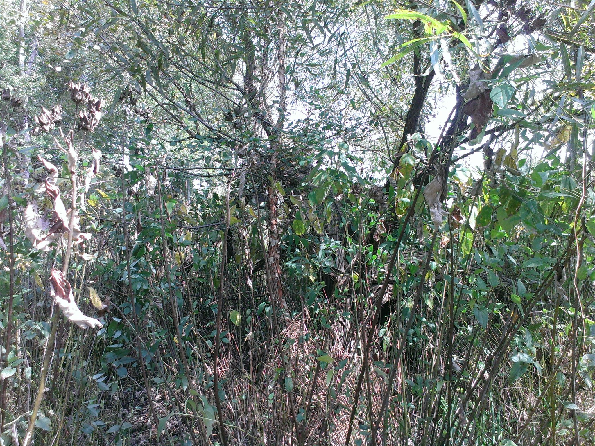 |
| The cache is in there somewhere.... |
So, finally, I reached the trail safe and sound, if shy a few milliliters of blood. But as Bloody Rob says, "No blood, no glory," and I reckon it's only fitting to shed copious quantities of blood on one of Rob's caches.
At least it wasn't my nose.
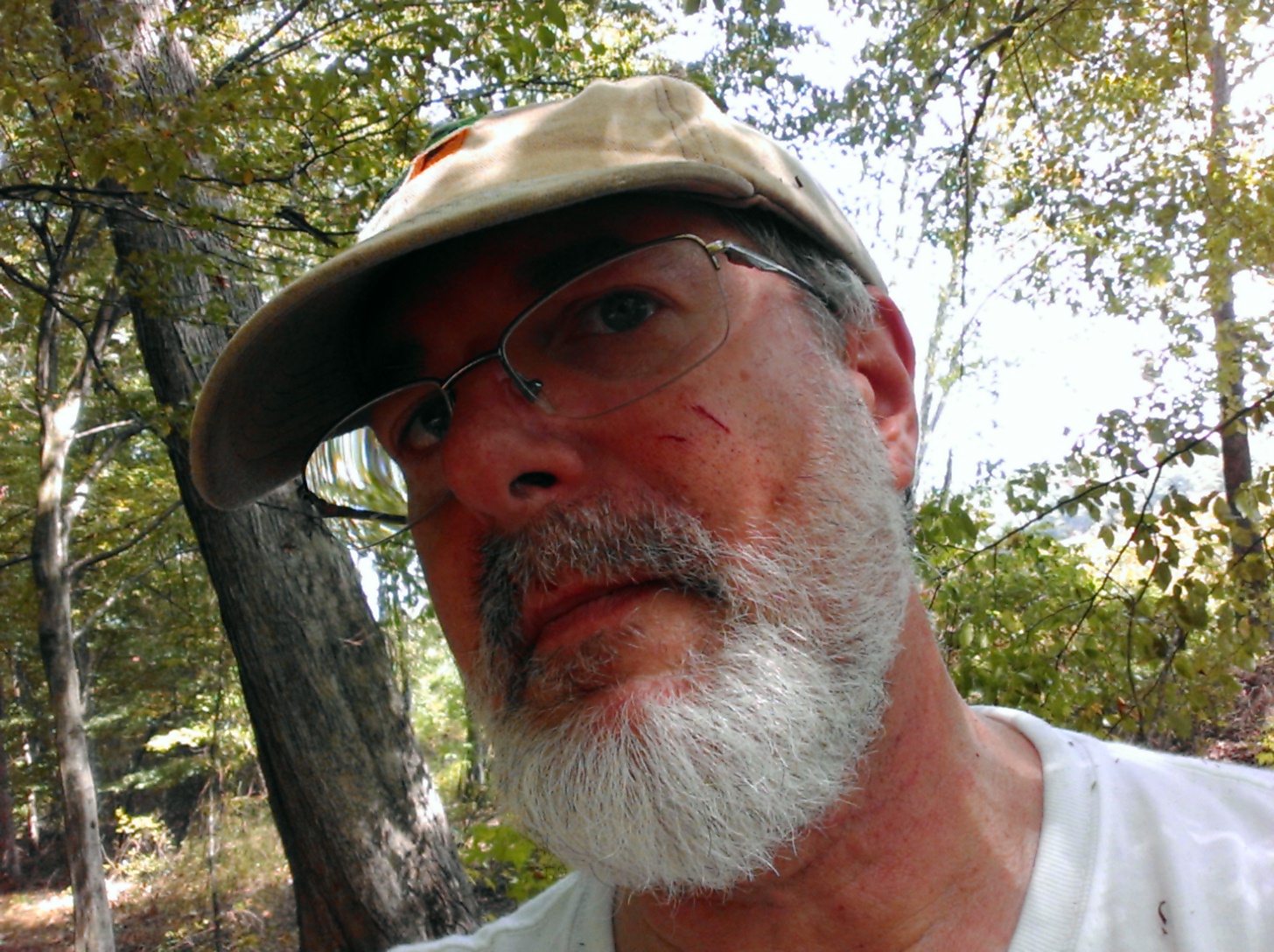 |
| No blood, no glory |
No comments:
Post a Comment