Brugger and I have both been burning the candle at both ends lately, so, this weekend, we're
gonna spend some quality time with each other and with some
fantastic creative folks we haven't seen in far too long. We decided to kick things off a day early by hiking out on the nearby Cedar Ridge Trails in the Chatmoss area and having a picnic lunch. I've placed several
geocaches on this trail system, and not too long ago, while I was exploring
one of the trails I hadn't visited before, I discovered a lonely, half-hidden
picnic table in the woods. So, this morning, we packed up some vittles and
hoofed it out yonder for a nice picnic. The peaceful solitude with Ms. B. was
just what the doctor ordered. A highlight was a little red fox that went
running by us, though too fast for me to snag a photo. Anyhoo, what a
beautiful day.
The Editor Known as Mr. Deathrealm. Author of The House at Black Tooth Pond, Blue Devil Island, Dark Shadows: Dreams of the Dark (with Elizabeth Massie), and many others. Feed at your own risk. Note: Stephen Mark Rainey is a participant in the Amazon Services LLC Associates Program, an affiliate advertising program designed to provide a means for the author to earn fees by linking to Amazon.com.
Showing posts with label Chatmoss. Show all posts
Wednesday, October 15, 2025
Sunday, June 1, 2025
Cedar Ridge Trails
Quite a few years ago, by way of geocaching (I know, what a shock, right?), I
discovered Cedar Ridge Trails in the Chatmoss neighborhood of Martinsville,
just a few miles from home. If I rightly recall, the trail system was at
least partially designed by my old friend, Jim Frith, who is a
long-time avid cyclist (he set a world record for jumping his bike over a row
of trash cans when we were in junior high school). Back in my earliest days of
geocaching, I hunted a geocache out at Cedar Ridge, and a short time later, I
placed a couple of my own out there.
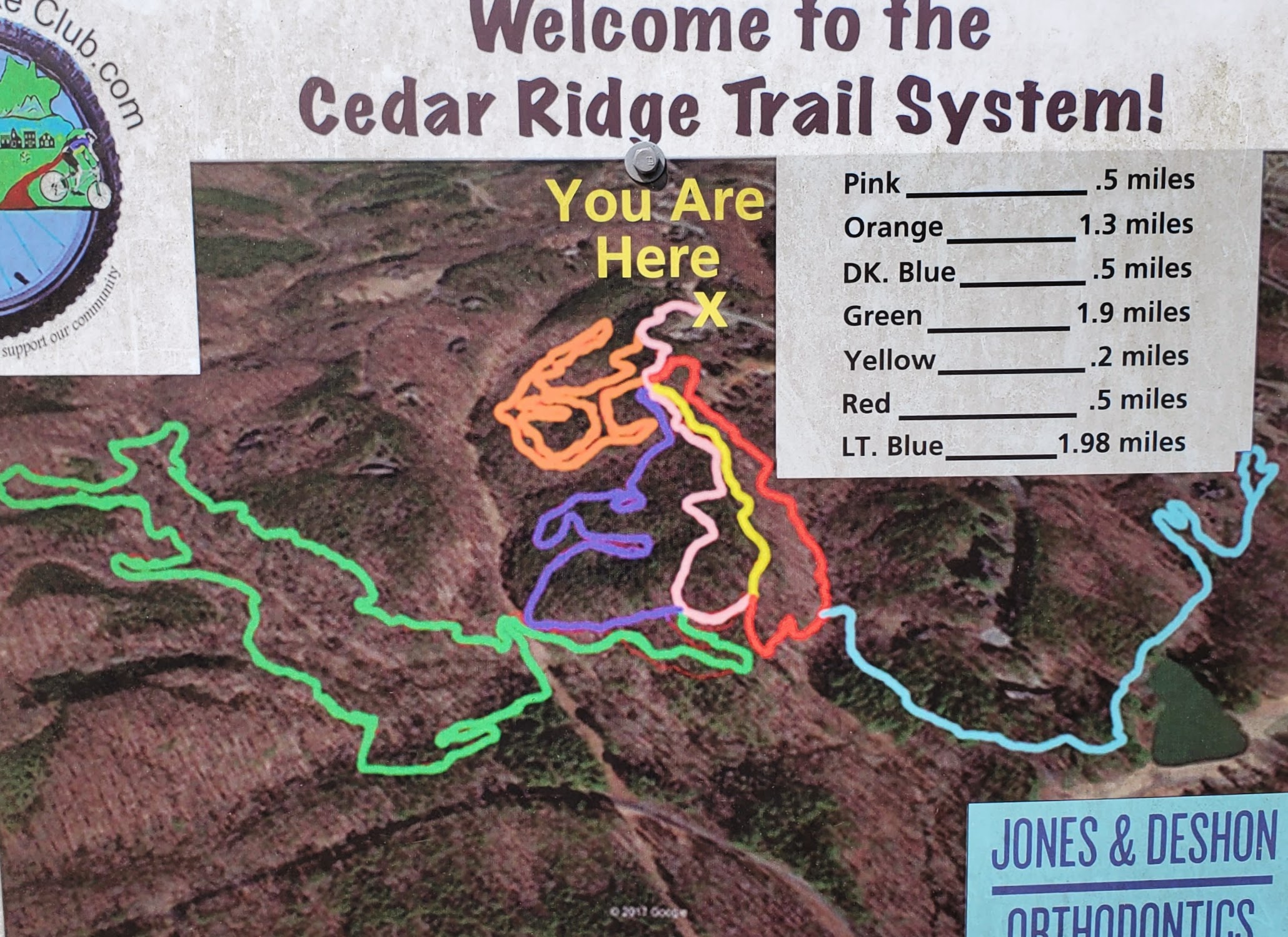
I knew there was a great deal of the trail system I hadn't explored, even
after all these years, so this morning, I headed out there to check on my old
caches and scope out some locations where I might place a few new ones. After
verifying my two caches were in place and in decent condition, I decided to
venture out into the area of the Green Trail, which extends out to the west on
the map above. The terrain out there is rugged in places, and especially on
the Green Trail, it's quite beautiful, as you may deduce from the attached
photos. The temperature hadn't yet hit oppressive heights this morning, but
the humidity and mosquitoes were pretty monstrous (despite having covered
myself head to toe with bug spray). Regardless, I fit in about three and a
half miles, and found several enticing locations to place new caches.
I expect I'll be going out there again this week to set up the caches. I
haven't yet set foot on the Light Blue Trail, out to the east, so I'll have to
give that one a go on a future outing.
Subscribe to:
Posts (Atom)