Showing posts with label haw river. Show all posts

Monday, March 30, 2026

Haw River Hiking

Back in 2011, when we lived in Greenboro, I placed a cache ("A Bridge Too Far," GC2VDEF) along the Haw River Trail in Glencoe, NC, and it's been lurking out there ever since. Apparently, though, in the recent past, either by natural or human interference, the cache went missing (I'm going with severe weather, since the location is pretty damned close to muggle-proof). So, this morning, I took the opportunity to head down there, replace the cache, and hunt a few others in the vicinity.
 
The Haw River Trail runs along the river for many miles, and most of it is very scenic (though the parts that aren't really aren't). Today's four-mile hike took me through some of both. Most of the trail is moderate, with only a few rugged patches, although when one steps off the trail to hunt or hide caches, all bets are off. I found a couple of nice newish ones on the trail, plus a few out in the sticks of Alamance and Caswell Counties.
 
I also discovered an excellent Mexican lunch at Crazy Mexico restaurant in north Burlington—a chile relleno and chicken quesadilla, which quite hit the spot. Good food, good service.
 
Sadly, I'm running out of geocaches to hunt within reasonable driving distance, especially with prices so high just now. But it was certainly a beautiful day, and I enjoyed the trip immensely. I may have one more outing like this in front of me in the foreseeable future, but after that, folks need to place more caches. Some of us might have a little addiction.

Thursday, January 16, 2025

Yee-Haw and More

It's been a cold, snowy week, during which sweet little Frazier passed away and Ms. B. got stuck in Michigan due to canceled flights. So, it was mighty nice to get out geocaching today with friend Scott (a.k.a. Diefenbaker). A passel of new caches have been placed between Greensboro and Durham—in Burlington, Graham, Haw River, Swepsonville, Mebane, Efland, and more—so we decided to tackle some of them today. We particularly enjoyed "Yee Haw," along the Haw River Trail in Swepsonville, which I hiked frequently when I lived in Greensboro. Very nice to return, it was.

We ran into friend Tom (a.k.a. Night-Hawk) while out on the road, so that too was fun. He'd come out to hunt some of the same ones we did (and we each picked up first-to-find honors on a handful of them).

There are enough of these new hides to keep us busy for a while, which makes me happy. And there are a few north of here as well, which I'll probably go after on my own, perhaps tomorrow....

TFTC (Thanks for the Caches)!

Monday, February 21, 2022

Oh, My Achin’ Feetz


It was a fine weekend for hiking and geocaching, and I put in more mileage, in rugged terrain, than I have in many moons. On my way to Martinsville on Friday afternoon, I detoured to the Knight Brown Preserve, near Belews Lake in Rockingham County, to hunt a cache that’s been awaiting my attention for months now. That hike was about a 3-mile round trip, and though the terrain is not particularly rugged, it presents the hiker with lots of elevation changes. Steep elevation changes. Speaking of elevation changes at the cache coordinates, there was a massive fallen tree over a gully, which offered a splendid vantage point from which to survey one’s kingdom. Always one to appreciate a physical challenge, I was hoping the cache might be up in its branches somewhere, but previous posted logs insinuated that it was not. Never you mind, I decided to go up in that tree anyhow, for we must get our jollies as we can. It was from that vantage point that I noticed the cache, just a few feet away, at a much lower elevation. I would have preferred to have to climb for it, but hey... I found it and signed the log so I could claim it. And I got my jollies in the big tree. That’s a good day.

Once settled at Pleasant Hill for the evening, I ordered some chicken tenders from Coach’s Neighborhood Grill via Doordash, and after the afternoon’s hike, the dead bird hit the spot. I put on This Island Earth for the evening’s entertainment, but I ended up dozing through a portion of it. It’s one of those science-fiction movies from childhood that have stood out in mind for all these years. I’ve watched it a handful of times in the intervening years, but I kind of hate that I missed part of it this time around. I can always watch it again, at least as long as it’s on YouTube. The print excellent — the best I’ve seen of it.

One of the things I adore about Pleasant Hill is the minimal light pollution at night. From the hilltop on which the house rests, the view of the sky is often spectacular. Friday night was very cold but clear, and I spent a little while outside enjoying the view. Even with my phone camera, I got a few decent shots of the constellation Orion.
“Orion, won’t you give me your star sign.”
On Saturday morning, I drove up to Rocky Mount, VA, hoping to claim a recently placed cache and a much older multi (which has been out there since before I started geocaching in 2008) called Grassy Hill Ridge (GCQXD4). The new one was a quick and easy find at a signpost; Grassy Hill Ridge is one that, a few years back, friend Natalie (a.k.a. Ms. Fishdownthestairs) and I had sought, but the first stage was missing, so we hadn’t been able to go on with the hunt. Reaching this cache requires a roughly three-mile hike up and down a rugged mountainside. For most of that hike, the ascent was steady, on a reasonably well-worn trail. However, the last few hundred feet required negotiating a very steep, rocky incline that tested the limits of my stamina. I took even more care than usual in rough terrain, since I was out there alone, a long way from help. I really did not want to fall and bust something worse than my pride. Happily, I made the find and returned to civilization with all parts intact. Aching, but intact.
Grassy Hill Ridge. Not much grass, but lots of rocks. The cache lurks way up at the top of the ridge—
several hundred feet above where I’m standing to take this photo.
Looking down from GZ, with the cache in the foreground. It’s a long, long way down!
After the hike and a late, ungodly overpriced lunch from Dairy Queen, I buzzed back to Greensboro. Ms. B. and I are back watching Game of Thrones from the beginning, so we spent most of the rest of the evening in front of the television, covered with cats.

Sunday, my traditional geocaching day, usually with the No-Dead-Weight Irregulars, was indeed a caching day, but with only friend Scott (a.k.a. Diefenbaker), as none of the rest of the gang was available. And it was another day of hiking rugged terrain, this time in the Uwharrie Mountains. We planned to meet at the Eldorado Outpost, but I had stopped for a cache on my way there, and Scott happened to see my car as he was passing by. We grabbed that cache and then headed to the trading post. From there, we headed deeper into the forest. We put in a good five miles of hiking in moderate to tough terrain, claimed a slew of caches, and returned to the outpost, where we enjoyed a very good, far more reasonably priced lunch than I’d had at Dairy Queen the previous day.
Old Rodan at “Poser Rock”
Guardrails along the woodland trail. Don’t see that every day.
A couple of tired old farts
Today, Monday, is Presidents Day, but since I’m no longer forced to operate on a company schedule, remembering such days doesn’t come so readily. Ms. B. is off work, though, so she is a woman of leisure today (although she did do a spot of housecleaning this morning, which was good, since the cleaning needed to be done, and it was most definitely her turn... haha). I was all set to finish up this blog and dive into continuing work on Georgia: The Haunting of Tate’s Mill, but right about the time I settled into my office chair, I received email notifications that a couple of new caches had just been published. These were over in Graham, on the Long Meadow section of the Haw River Trail. Figuring I might be able to snag the first-to-find honors (which really aren’t a significant honor), I bolted out the door and drove out to the trail. Happily, I was able to find both caches — and, sure enough, I found them first. So, the old sore feet got an additional reason to be sore, though this hike (about 2.5 miles) was not rugged at all. But it was fun. And I got first-to-find.

NOW it’s back to work on the Ameri-Scares book. Toodles.
Passing under Interstate 40/85 on the Haw River Trail
Ground Zero: the cache is there... somewhere.

Sunday, January 9, 2022

Winter Storms, Blogger Fuckery, Historic Churches, and Smoked Cow

Immediately upon our return from Myrtle Beach last weekend, dire weather fell upon us. We had only a light coating of snow, but there was ice aplenty and winds like I've not heard since the last hurricane to blow through here some years ago. We lost power at 4:00 a.m. Monday morning, though it came back on about noon — some kind of speed record for Duke Energy. Our yard became a mess of branches and sticks, but next door, a whole tree uprooted and fell. It remained as you see it in the photo above for several days, until finally, this weekend, the neighbors took it upon themselves to get rid of it. Rather than call professionals — an admittedly expensive prospect — they employed a couple of friends, a pair of electric chainsaws (one of which got stuck in the tree for a day or so), an assortment of wooden boards, a footstool, and a pickup truck (which got stuck in the mud in their backyard for a day or so). 
"Maybe if we put this over here, and that over there...?"
At this point, the chainsaw is stuck in the tree, and the truck is stuck in the mud.
On Friday afternoon, I headed to Martinsville while the trio of men were out there working, so I didn't get to see how things eventually unfolded. But when I arrived back here yesterday, the tree was gone. The fence between yards (which I believe actually belongs to the neighbors behind the next-door folk) failed to escape damage (relatively minor), and there are deep ruts and mud splatters aplenty in their backyard (and part of ours). However, to the best of my knowledge — and by some minor miracle — none of the guys out there suffered death or dismemberment. I guess you'd call that a win for do-it-yourselfing.

More snow fell in Martinsville than here in Greensboro, but there appeared to be less ice and far less property damage. I have no idea whether it was actually storm-related or not, but the heat pump at Pleasant Hill had ceased the pumping of heat, so I found the house rather chilly. Yesterday morning, I managed to engage a service tech, who determined the system needed a new thermostat. He installed one, which got the heat pump working again, but a most complicated device, this thermostat. I hope I can figure it out without needing to go back to school to get an engineering degree. In any event, I managed to get the Christmas decorations taken down and finish up a significant writing project, which I'll be promoting the hell out of in the coming days.
St. Matthew's Episcopal Church
in Hillsborough

Since today's weather, at least for the morning, appeared conducive to geocaching, three old farts — Scott (a.k.a. Diefenbaker), Old Rob (a.k.a. Old Rob), et moi — decided to head eastward to several different locations, culminating in Hillsborough, where a new Adventure Lab cache awaited us. First, we headed to the Haw River Trail in Graham to see if we could snag first-to-find honors on a newly published hide (we did); then we zoomed over to a nearby park & grab hide, of which we made very short work; and finally, we moved on to Hillsborough. The Adventure Lab cache ("Historical Churches of Hillsborough") took us around the town's picturesque historical district, to... guess what... several historical churches. Hillsborough is a lovely town to walk around, and we enjoyed the opportunity to see the sights (again).

We topped off our Hillsborough outing with a visit to Hillsborough BBQ Company, which is a longstanding tradition when we're over in that neck of the woods. I'm a smoked beef brisket junkie, and Hillsborough BBQ Company has historically had some of the best brisket I've ever tasted. Some time ago — over a year, I'm guessing — we had visited to find the brisket not quite up to snuff. Not bad, just not top-notch. Someone we met on another caching trip told us that the restaurant had changed their smoking time or process or something, but the brisket was definitely inferior. Regardless, I wanted to make sure they had another chance, and this time around, it was better. Much better. Maybe not quite what it used to be (and certainly not as eyes-rolling-back-in-the-head-incredible as The Smoke Pit in Salisbury, which is now our favorite brisket venue), but we were altogether satisfied. Plus I found a really good, jalapeno IPA (Fire Escape, Asheville Brewing Company). So Hillsborough BBQ is most definitely back in my good graces (not that it ever fell very far).

But speaking of falling far....

The most frustrating — no, infuriating — issue of the weekend was discovering that Blogger (and by default, Google) fucked up my blog in numerous instances by their constant altering of code. At one time, formatting this blog, including placing photos (for which one might have a reasonable expectation of being permanent, since they're from Google's own blog photo hosting site) was simple. You could pop a photo in, place it as you desired, look at the html code, and see the photo ID in the code. No longer. Now you get typical Google Photos gobbledygook for the ID, leaving you with no way to trace it back to its origin. But the worst issue here was that a shitload of my blog photos, mostly from 2017, now displayed only broken link images. So I ended up spending a massive amount of time replacing and relinking the pics — with no guarantee the code will actually hold. Jesus God...  this constant ABSOLUTELY GODDAMN NEEDLESS fucking around with the blog code by bunch of technological halfwits is so infuriating, if it were up to me, I'd shitcan the lot of them (the decision makers, anyway) and make sure not a one of them could work in a technological environment ever again. Maybe cleaning shit out of pigpens would be more suitable.

Anyway. Go on, git. Bye.
Three Old Farts: Old Rodan, Old Diefenbaker, Old Rob

Sunday, February 28, 2021

High Haw, High Haw

A few new geocaches along the Haw River, just north of Burlington, came out this week, so the Haw River Trail looked like the perfect destination for a relatively lengthy hike today. Sadly, of the Socially Distant No-Dead-Weight Irregulars, only friend Diefenbaker (a.k.a. Scott) was available, though he did bring his faithful cache hound Tink with him. After ungodly amounts of water dumping from the sky for two weeks or more, the trail might have been a little muddy. Tink particularly enjoyed the myriad temporary pools and ponds; by the time we were done for the day, the Diefenbaker duo was in need of a good scrubbing.

The morning started out foggy and chilly, but in short order, the fog broke and the temperature rose. There are several older caches along the trail, which I had already found but Scott had not, so we stopped for those as well as the new. As is often the case along the Haw, the cache hunts took us to some cool locations, including a set of massive concrete supports for a couple of long-gone propane tanks, now overtaken by woods. That is the kind of stuff I love finding in the woods. Along the way, we ran into friend tbbiker (a.k.a. Todd) heading in the opposite direction, so we enjoyed chatting for a spell before going our separate ways. Then — shades of last Sunday at the Cane Creek Mountains (see “Rusty Wreck & Others”) — as we made our way back to our vehicles, friends David & Diana (a.k.a. David & Diana) came along, intent on hitting the trail themselves.
 
At the end of it all, we found four caches (a handful of extras for Scott), put in a good four miles in messy, mucky terrain, and burned a few hundred calories. Plus I did a good deed and repaired one of friend Yoda Rob’s caches, which needed some serious TLC.

Not at all a bad day’s effort.
The morning started out foggy and chilly. It didn’t stay that way very long.
Concrete supports for old propane tanks, now swallowed by woods
Clearly, this is an antique Confederate rocketship, all set to take off for the moon.
It doesn’t pay to go speeding through the woods in one of these things!
Scott trying not to be seen
Tink, the very muddy cache hound
Old Rodan and the very muddy Haw

Monday, December 28, 2020

Can’t Hold Me Back

Thingummies overlooking my parking spot across US 70 at Haw River. Nah, I’ve no idea.

Why, yes I did need a rigorous geocaching adventure for today. There was a relatively new cache — “Can’t Hold Me Back” (GC93Y4W) — along the Haw River in Alamance County, just north of Burlington that looked promising, so I decided to make my way over yonder. The cache listing shows a set of parking coordinates, but they are quite remote, and I knew that legitimate roadside parking exists nearer the trailhead. However, that area turned out to be so muddy I feared I might end up needing AAA if I dared plant the Rodan Mobile there. When caching in this area a few years back, I had parked along US 70, near the southern end of the Haw River Trail, so I drove down to that location to see whether it appeared usable. It did, so I went for it. Across the road, there were thingummies watching me. No idea what they are about. Anyway, parking there shaves a wee bit of mileage off the hike, but what I saved in distance, I more than made up for in terrain difficulty....

Do you remember drought? At times like this, I recollect it fondly. The Haw is running high, fast, and hard, and there is flooding all around the trail. Before I even reached Boyd’s Creek, a fair-size stream that intersects the trail — today quite swollen — I had achieved the rank of Major Muddy Mess. The creek looked to be about waist-deep, so I went upstream a quarter mile or so and found a big log to use as a makeshift bridge. I stayed dry, but given the added distance, I resolved that, on the way back, I would attempt the water crossing. 

My makeshift bridge across Boyd’s Creek

At ground zero, I found the cache in good order. My pen didn’t much want to write, but I managed to get my signature on the log. About the time I started back toward the Rodan Mobile, I saw several deer grazing nearby. Then began the gunshots at frighteningly close range. I hadn’t thought to wear blaze orange (something to consider in this area during hunting season), so I made my egress from the area wildly waving my hiking stick and whistling Ennio Morricone’s “Ecstasy of the Gold” from The Good, the Bad, & the Ugly soundtrack at very high volume.

Back at Boyd’s Creek, I bit the bullet and made the water crossing. Someone had been kind enough to tie a rope across the creek, which is the only reason I didn’t end up totally submerged, for those unseen rocks down there are slickery. Happily, the water was only knee-deep, rather than waist-deep.

Boyd’s Creek water crossing, outbound; nice that someone has tied a rope across the water
Boyd’s Creek water crossing, inbound: chilly!

I was relieved to finally reach the Rodan Mobile, although it was not at all happy to see me, since I was covered in more mud than Lon Chaney as the mummy after sinking in quicksand at the end of The Mummy’s Ghost.

So, this outing proved rather more invigorating than I had expected. Although I did let loose a colorful metaphor or two along my trek, I can’t say I didn’t have fun. So, to the cache owner, all my appreciation for the new geocache and the opportunity for another adventure!

The Haw River: very high, very fast
An awful lot of this...
...and very few of these.

Sunday, December 8, 2019

Another Haw River Hoedown

A handful of The Usual SuspectsDiefenbaker (a.k.a. Scott), Fishdownthestair (a.k.a. Natalie), and an old dude (a.k.a. an old dude) — badly needed to hike and seek some geocaches today. So off we rode to the Haw River down near Pittsboro. We've cached that area numerous times, though just north of US 64, there is a trail along the river with a number of nice caches we had yet to conquer. That we did, but for one very old cache "Craggy Haw" GC1JCRP, placed in 2008), which is most likley missing. Otherwise, the hike proved scenic, occasionally rugged, and altogether satisfying.
I wonder what might be lurking in that big old
column of stone way back in the woods....

After the river hike, we landed ourselves at Carolina Brewery in Pittsboro where, unbeknownst to us, a gaggle of local geocachers had also landed following a nearby CITO (Cache-In, Trash-Out) event. We arrived right at the tail end of the event, but we did see quite a few familiar faces (and in a few cases, entire bodies). We exchanged a round of greetings before most of them departed and then proceeded to procure ourselves some vittles and liquid refreshment. Nice!

On the way home, we stopped for another handful of caches. And we got run off from a stand of woods where a cache apparently used to be but that now belongs to some nearby property owners who were unaware of such wondrous things as geocaches. Alas.

All in all, though, a satisfying day of exercise, good company, and decent refreshment.
Islands in the stream
A sunny day at the river

Sunday, April 8, 2018

From Ferrum to Saxapahaw

Some nice Geocaching buddies near Ferrum, VA
Closing in on 10,000 geocache finds, I am. Picked up an even dozen this weekend, bringing my total find count to 9,921. I am hoping to make the 10K find... whenever and whatever it might be... something memorable, so I need to start doing my research. It would be great if it involves kayaking and is close to a winery, in which case Ms. Brugger would be inclined to join the fun.

After spending Friday and Saturday looking after my mom in Martinsville, I set out after a few caches before heading home. Three new ones had come out around Ferrum, VA, where I went to college back in the darkest of dark ages, so I decided to target them. They had been published several days earlier, but, surprisingly, no one had logged finds on them. Fortuitously, I managed to claim FTF on all three by an hour or so, as longtime geocachers (and forest rangers) TracksAll & Will Ketchum apparently came along soon after me. I almost feel bad for beating them to the punch, since they don't get to cache nearly as much as they used to. But hey, a smiley is a smiley, and an FTF is a damn near empty honorific, at best.

From there, the Rodan Mobile conveyed me to Fairy Stone Park, where I have spent many happy times and found numerous caches over the years. There was a relatively new one there, which did not appear to involve significant hiking... until I opted to depart the trail and make a beeline for the cache. Making a beeline for the cache turned out to be more like hauling one's self up and over one majestic incline after another, and reaching the cache involved a rather precarious change in elevation just above a creek. On my egress, I decided to keep to the trail, which proved less rigorous but also involved no little altering of altitude.
Hanging out with funky little Tiki Dude

Then it was on to Eden, NC. Here, there were several more to find (two of which I sadly did not), including a wondrous, beastly little hide amid a massive network of roots in a deep, dank ravine, which I found to be a pure joy in the driving rain that had begun to fall. You may think I speak facetiously, but I do not speak facetiously, for I had a grand time of it making this find (admittedly with a modicum of help from friend Night-Hawk (a.k.a. Tom).

Drenched and exhausted, I eventually made it home. Then, this morning, friend Robgso (a.k.a. Rob) and I made another fine day of it, first at Hagan Stone Park in southern Guilford County, then at Cedar Rock Park in Alamance County, and then in 
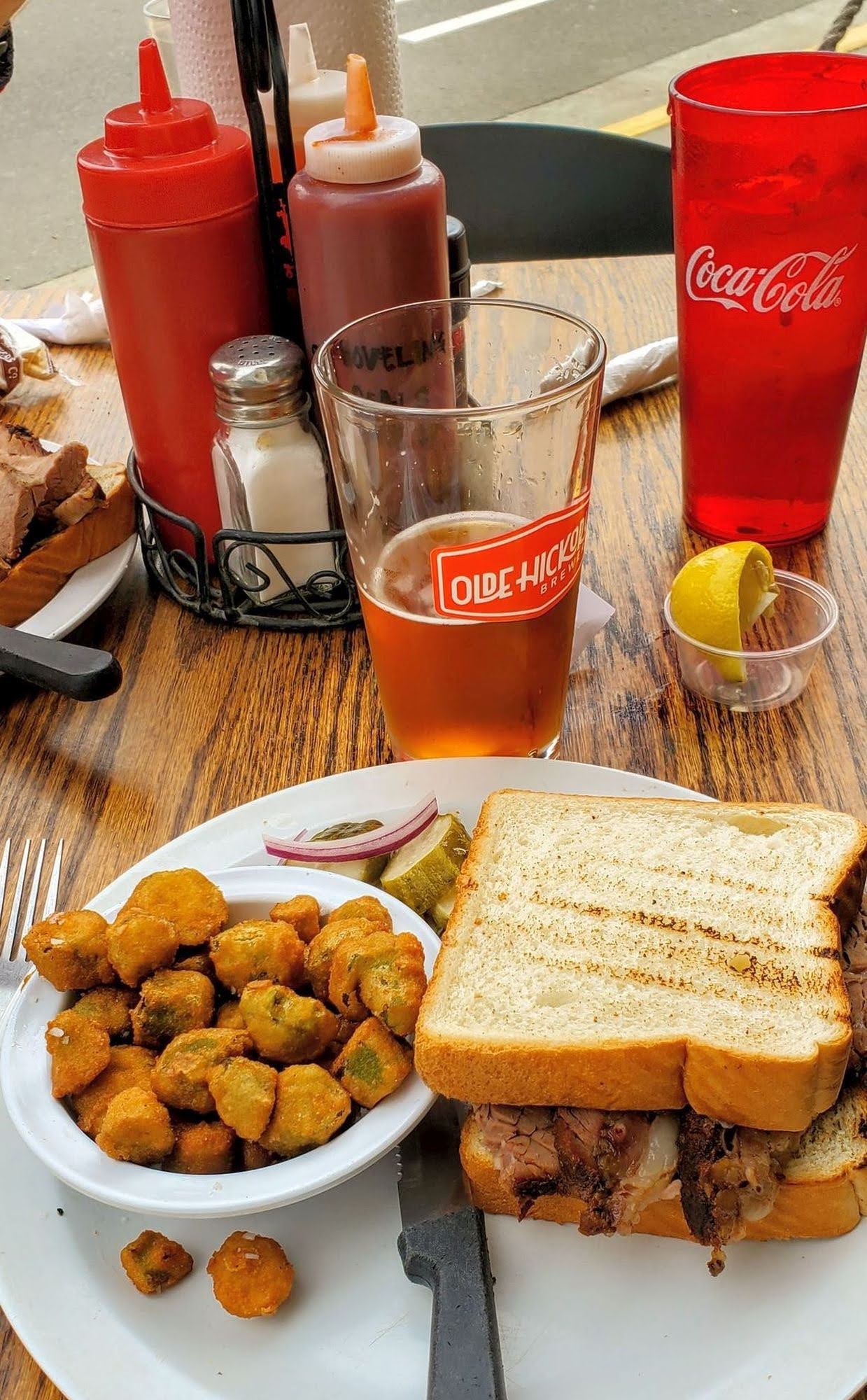
Saxapahaw, on a scenic trail along the Haw River. Lunch at the Saxapahaw General Store was, hardly unexpectedly, among the day's highlights. Ms. B. and I have had some mighty good meals at this place over the years, and today the goat burger was the item of choice, and a fine one at that. Caching-wise, we found a couple of particularly enjoyable hides, including a rat in a tree and a funky little coconut Tiki dude. We finished our hunt—successfully—at the edge of the Buckhorn Gamelands, where we have cached on many previous occasions, and then we came home, where I fell over and went boom.
Rodan's Roots?
View of Philpott Lake from the Lake Shore Trail
View of the Haw River
Found along the Haw River Trail
Old, crumbling dam on a Haw River tributary

Sunday, January 31, 2016

Haw, Haw, the Laughing Dead

Jesus Rob
Mercy, it's been way too long since I went out on a lengthy, invigorating trail hike to hunt a bunch of geocaches — something that not so long ago was at least a weekly, sometimes daily event. One of the drawbacks of being an avid geocacher is caching out the nearby environs and having to travel farther and farther afield to find any appreciable concentrations of caches. Add to that our recent bout with severe winter weather and the fact I'm now having to manage virtually all of my mom's affairs in addition to my own, and the opportunities to get out there have been pretty slim. But thanks to a new extension of the Mountains-to-Sea Trail along the Haw River in Alamance County, a balmy day, and a bunch of new caches courtesy of the nefarious "Yoda" Rob Lee, regular caching crony "Bloody" Rob Isenhour and I were able to put in
Can you undeerstand?
a good five to six miles in the woods and claim seven caches, with first-to-finds on three of them. Most stimulating for us, along the trail we came upon numerous crumbling, abandoned structures; discarded implements of death and destruction; and a few wrecked, rusting vehicles. We also witnessed a number of strange figures around (and in one case on) the river, some shambling silently through the shadows, others wailing and screeching in what might have been an alien tongue. By keeping a low profile, though, we passed more or less undetected through the woods, and thus lived to tell our tale.

The journey was not without some physical challenges of its own. While for the most part the trail is not terrain intensive, and none of the caches required any significant acrobatics to retrieve, several times we ventured into the surrounding environs to check out some of the more intriguing sights, and there is one stream crossing where no bridge, deep water, and a trail of submerged rocks make for an interesting experience. Neither Rob nor I fell in, but we each did our own version of a victory dance at the end, and neither were what I would call graceful.

I did discover what looks to be the perfect spot to place an evil, monstrous, dangerous, devious, heart-stopping, maybe kinda cool cache. This will require a return trip. Whether I can survive this endeavor remains to be seen. You'll no doubt hear about it one way or the other.
No survivors
One of the myriad structures near the trail we detoured to explore. We went with caution, for we figured
there might be Walkers nearby.
One of several implements of death and destruction we came upon. Hark! What's that sound?
Oh, lord, yes. There be Walkers here. Run! Run like hell!