Showing posts with label Team No Dead Weight. Show all posts

Sunday, June 12, 2022

Happy Diversion

Today, our usual Sunday morning geocaching outing consisted solely of the Old Farts — Old Diefenbaker (a.k.a. Scott), Old Rob (a.k.a. Old Rob), and Old Rodan (a.k.a. me). Our initial plan was to see if we could snag a few in Mebane, about 25 miles down the road, and then a few in Hillsborough, another 15 miles or so farther on. However, just as our aging gang was hobbling out of the house, notifications popped up for a series of six new hides in Burlington, which is several miles closer than Mebane. So, we altered our course and diverted to Burlington Springwood Park, which is a fairly large — and this morning, a very busy — facility. By the time we arrived, around 10:00 a.m., there were already several softball games in progress on the ballfields, and a disc golf tournament was just getting going. Muggles coming, going, in, out, up, down, and all around....

Undaunted, we parked the Rodan Mobile and set out on foot after the caches — five traditionals and one mystery cache. Each traditional contained information necessary to unlock the final mystery cache. The heat was hot, we hiked about three miles, and we had trouble finding a couple of the caches, so by the time we found the entire bunch, the evil day star was on the verge of getting the better of us. In the plus column, we met a family of cachers, whose team name — Phersjm — we knew from their many geocaches in the area, but this was the first time our paths had ever crossed in the field. Actually, our paths crossed twice, which was nice.

Happily, the No-Dead-Weight Irregular Old Farts scored six of the almost-maybe-kinda-sorta coveted first-to-find honors. And we met a very friendly black rat snake, who slithered by to check us out for a bit. He let me get quite close to him to take a few pictures, which I appreciated.

After all this, we headed on over to Mebane, where we found four more caches and an excellent lunch at Catrina’s Mexican Restaurant, which has become one of our favorite lunch destinations when we're caching over that way. Great food, and an extensive selection of it. The Rodan Mobile arrived back at Casa di Rodan about 3 o'clock and disgorged a bunch of weary, sweaty, filthy-dirty old men. Well, I'm not saying dirty old men, except, well, maybe, there's Scott....

Bye for now.
Dude just keeps on slithering out of the greenery.
He's easily a six-footer, if not more.
"Hello, Mr. Man, I am ready for my close-up."

Friday, August 27, 2021

Light at the End of the Tunnel

Yes, that tunnel you see right there. That was the No-Dead-Weight Irregulars' primary target on last Sunday's geocaching outing because, yes, there is a geocache in there. The team had a pretty full complement — Diefenbaker (a.k.a. Scott), Fishdownthestair (a.k.a. Natalie), NCBiscuit (a.k.a. Linda, but just for this one cache), Old Rob (a.k.a. Old Rob), and this old dude. As far as tunnels go, it wasn't a particularly lengthy one, but it did present a physical challenge or two to conquer before one could access the cache. And there was, quite literally, a light at the end. Scott turned out to be our wade-the-waist-deep-pool-and-scale-the-ladder-to-grab-the-cache man, and he did admirably — until he dropped the cache in the above referenced pool, which required him to come back down, retrieve the cache, and climb back up. I'm sure it was all as much fun for him as it looked, and we each earned a smiley in the deal.
 
Diefenbaker signing the logsheet, moments
before he dropped it into the water below

After we emerged from the not-so-daunting darkness, Ms. NCBiscuit left us for different pastures, and the rest of us meandered Chapel Hill way, where we grabbed a quite a few more caches, most of them of high quality. A fine day of it overall, akin to the days of old, when the full gang could spend the better portion of the day hunting all varieties of caches, fit in all kinds of decent exercise, and lay waste to a passel of decent vittles. This time around, we found a fine feast at Casa Maria Latino Restaurant on Franklin Street in Chapel Hill. We've been there numerous times, and it's always quite good, though for whatever reason, they weren't serving alcohol — a bummer because some of us had been craving margaritas. Don't know whether they lost their ABC license or what, but I hope it's not a permanent situation. More often than not around here, a restaurant loses is liquor license, and the next thing you know, the restaurant has ceased to exist.

On last Friday, after an early workday, I met friend Skyhawk63 (a.k.a. Tom) over in Pilot Mountain to hunt a newish Adventure Lab. It was enjoyable enough, and we completed it readily. I snagged a few additional hides afterward on my way to the old homestead in Martinsville. I hadn't been into Pilot Mountain in ages, and I did discover that, like Eden, NC, they also have their very own Bigfoot. It's a very flat Bigfoot — a piece of sheet metal on the side of a building in the middle of town — but I always do get a kick out of seeing him around as much as I do. To think so many people live their lifetimes never seeing Bigfoot and consequently not believing in him. Well, I've seen, and I believe.
Mount Pilot's very own Bigfoot

Apart from the geocaching, I've done precious little these past couple of weeks other than work like the dickens on a story for a new anthology. Due to so much happening on the homefront, I had missed the official deadline, but I still had a small window to get the story in. I trust it will please the editor. I found it, in the end, a most gratifying tale to write.

And I'll be back hard at the writing in the coming days, for I need to get back on the Georgia book for the Ameri-Scares series. I had started into it a while back but had to put it aside for a time while the wedding, the home renovation, estate business, and the regular day job ate up every hour of every day. I like to keep busy, but I really hope things don't build up to that beyond-intense pace for a long, long time... if ever.

Today, of all things, I did something I've not done in over a decade: I went out and played golf. Friend Terry invited me to go along, and I decided to do it. Years and years ago, I was quite the avid golfer, but these past few decades, it really hasn't been in my repertoire. Today, I scored about as well as one might expect after ten-plus years away from it. But I managed to nail a few beautiful shots, and I really did have a great time. I don't know that I'm going to become a habitual offender again on the golf course, but then... stranger things have happened.

And that's all for now, so sayonara and peace.

Sunday, November 15, 2020

Monster Stars, KVegas, and Korner’s Folly

The Socially Distant No-Dead-Weight IrregularsMs. Fishdownthestair (a.k.a. Natalie), Sir Diefenbaker (a.k.a. Scott), and a way-out old dude — managed to regroup today after too long a separation due to factors beyond reasonable human beings’ control (note that only one of us is reasonable). Since our last outing at Tanglewood Park, near Winston-Salem, NC, a few months back, a number of newer geocaches have been published, so we decided to dare the forecast for rain this morning and undertake a near-six-mile hike through the park. Hike we did, find caches we did, and get wet we did not. Well, not very, anyway. The only rain was a few drops that spat on us for about 30 seconds. Fortunately for us, that was the extent of it, for we had reached the farthest point of our hike when the dribble began.

A touch of fall color

Every year, Tanglewood Park puts on an extensive Christmas festival of lights, which draws crowds from all over the state and beyond. I have never experienced this spectacle for fear that the human multitudes would send me into a fatal apoplectic fit. However, as the show begins this coming week, the park has been fully decorated, the framework for bunches of impressive light sculptures erected. I can’t say I wouldn’t love to see the event as it was meant to be, but I would kind of like to survive the experience.

Following our scouring of the park, we moved back eastward to Kernersville, where a new-ish Adventure Lab cache — “The Hot Spots of KVegas” (GC923TV) — had come out a couple of weeks back. Kernersville is an attractive, pleasant community halfway between Greensboro and Winston-Salem — or would be pleasant if not for the goddamn over-saturation of humanity that has resulted in almost perpetual gridlock, even on off days such as Sunday during a pandemic. On the plus side, we got to re-visit some of the areas that Ms. B. and I have frequented over the years. When we were still working in the office, we were close enough to Kernersville to spend a fair amount of time there, since they had several nice dining/wine and eclectic shopping options (not to mention geocaches). Today, our hunt began at Korner’s Folly, Kernersville’s most notable historic building. From there, we hoofed it to several other stops in town before moving on to the final stage.

Triad Park, just east of Kernersville, turned out to be our ultimate destination. To locate the physical bonus cache, we had to gather information from the Carolina Field of Honor, which is an impressive tribute to NC veterans. We found the cache, all right, and that turned out to be a fitting end to the day’s adventure.

And what a week I have coming up, workwise and otherwise, as I am now going hard about the duties of being executor to my mom’s estate. For every hurdle I cross, two more pop up. A long, slow, frustrating process this is. But everyone warned me it would be. Everyone spoke truly.

Till another day.

Monster Moravian star at Tanglewood about to devour two unsuspecting victims
A charming little church at the park
An old graveyard in the middle of the park, which was built around it.
Another nay-sayer. What a poor attitude!
Korner’s Folly in Kernersville, one of the town’s most attractive historic buildings
A nice little corner behind Korner’s Folly

Sunday, July 12, 2020

Shooting for 12K

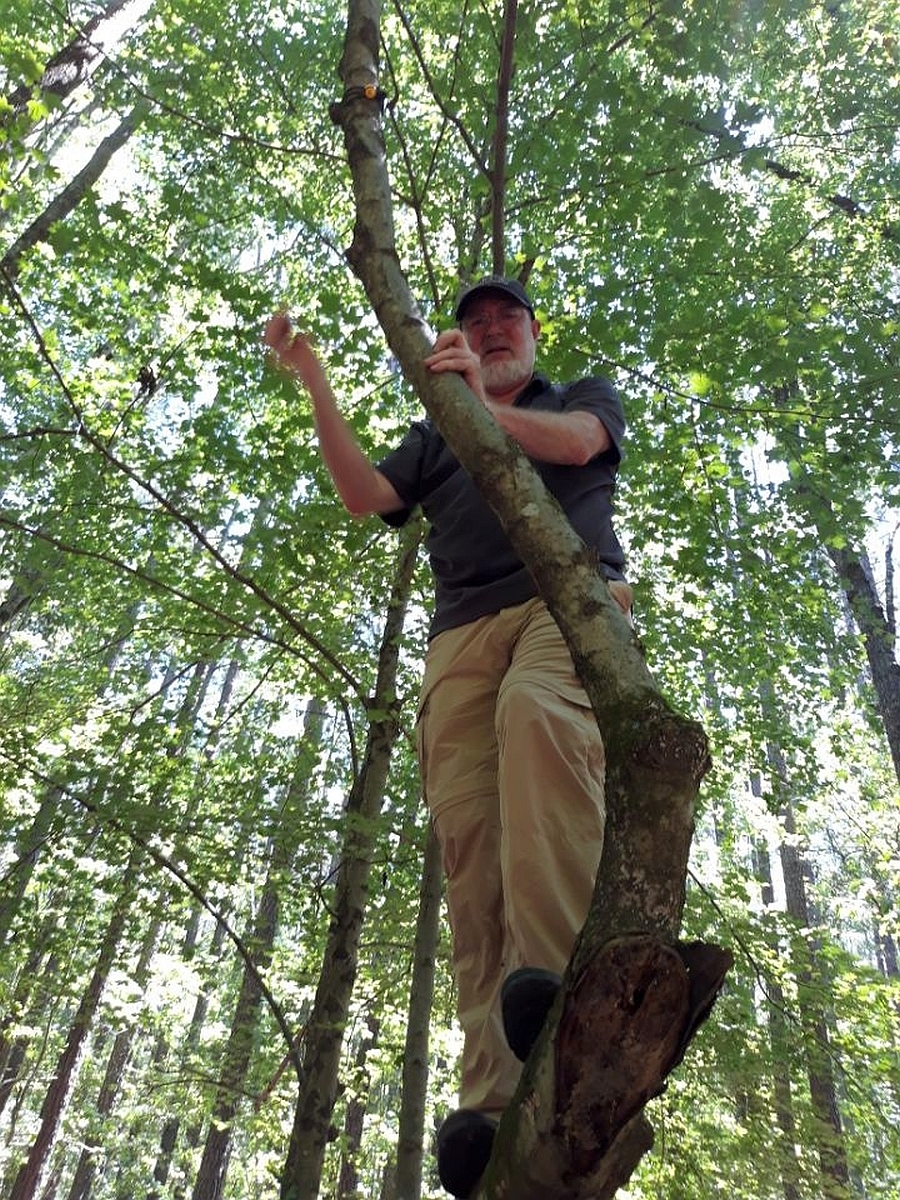
What do you reckon that old fart is doing up there?!

12,000 geocaches, that is.

Team No Dead Weight, consisting of the usual pandemic-era suspects — Diefenbaker (a.k.a. Scott), Fishdownthestair (a.k.a. Natalie) and Old Rodan (a.k.a. me) — gathered again today for a customary Sunday on the trail. This time, we headed back to the Carolina North Forest in Chapel Hill, where a passel of relatively new geocaches awaited our unique brand of attention. We’d been there a few weeks ago, and — wouldn’t you know it — an hour after we departed the forest, a bunch of new caches were published, right in the same area we had been hiking.

The forest occupies 750 acres of land on either side of Seawell School Road, which runs north/south on the northwest side of Chapel Hill. I have hiked/geocached in the forest numerous times over the years, but today was the first time I basically hiked roughly the entire perimeter of the forest. Most of today’s caches were pretty simple, requiring few feats of acrobatic prowess, although I did go up a tree I had already negotiated some years ago just so I could help Ms. Natalie reach the cache, an older one that hangs in a fairly high place.
Scott performing minor acrobatic feats

So, yep, we cleared out every cache we had yet to find in both sections of the forest — fifteen there or about, requiring roughly seven miles of hiking. The temperature hovered around 95 the whole day, and the humidity made it feel like we were breathing mayonnaise. But we persevered, and figured that, after completing the hike in the forest, we would call it a day.

But wouldn’t you know it... just before we set out for our respective homesteads, Natalie realized four brand-new caches had been published, a relatively short distance from the forest, along the Booker Creek Greenway, which Ms. B. and I have hiked together on occasion. The new caches had been live for about three hours, but no one had logged them as found. So we set out after them, hoping we might snag the coveted first-to-find (FTF) honors.

What do you know? We did! How happy. We finished the day having put in very close to 9 miles of hoofing it; some pretty rugged, some relatively easy. The heat just about did us in, though. I mean, whew! Adding ithe handful I found in Mebane while coming and going, my current geocache count stands at 11,991. So, I figure I will pick up eight caches this week and, on Sunday, plot an outing for some slightly more-extravagant-than-customary cache for #12K. I am leaning toward either one way up in a tree or deep in the underground.

The plotting thickens.
Natalie seems to find the cache log amusing.
One of many large mounds that rise out of the forest like little mountains
A little Bigfoot cave, I’m pretty sure.
Old Rodan watching for little Bigfeet on the prowl
“Knee-to-Knee” sculpture in the brand-new Mebane Community Park

Sunday, June 28, 2020

South of Heaven: Abyss

Team No Dead Weight
Team No Dead Weight: Old Dude, Scott, Natalie. I just realized these two were not properly socially distanced
here. At least, I was good. I am always good. Sort of.
I haven’t come home from geocaching so hot, wet, and filthy dirty since the last time I came home so hot, wet, and filthy dirty, and that is some kind of hot, wet, and filthy dirty. Team No Dead Weight — today’s incarnation consisting of Fishdownthestair (a.k.a. Natalie), Diefenbaker (a.k.a. Scott), and I — set out this morning for Chapel Hill/Durham for the express purpose of knocking out a few geocaches that require venturing into the deep, dark underground. We ended up in five tunnels, I believe it was, two of which were part of a single multi cache.
Our view for the better part of the day

We started out with a fine multi called “Preparation H: Feels Good on the Hole” (GC340DE) in Chapel Hill. It’s one of a series of “Preparation” caches, which require you to have some particular tool of the trade in order to acquire the prize. In this case, the tool in question is a flashlight, and we made sure we had an adequate supply of them for our trek. The first stage led us to not so much a tunnel as a tight, lengthy enclosure under a bridge. The object bearing the coordinates to the next stage proved quite challenging to turn up. Reaching the second stage did require going into a bona fide, fairly lengthy storm drain tunnel. The stage itself was not a container per se, but a novel method of revealing coordinates to the actual cache. It lurked just off a nearby trail, at ground level, but on what is called, in the vernacular, high ground. Someone was kind enough to leave a rope to assist with our ascent and descent. A bloody fun hide this one.

Next, we sought a little monster called “Strategies Against Architecture: Darkness” (GC1JXYB), deep inside a narrow tunnel that required crawling to negotiate. Not my favorite means of ingress, I can tell you. And sadly, this effort turned out to be a bust. The cache may still be in there, but damned if we could find it. This cache and the next two were placed by friend Vortexecho (a.k.a. Christian), who is well-known locally for his more extreme geocache hides.

Scott trying not to fall down go boom
We had similar bad luck at a much longer tunnel — “Mind the Frogs” (GC1JZC1) — in which we could stand partially upright, at least. This journey turned out to be fairly lengthy, our search intense, but once again, we got skunked. Most depressing, since we did put in such effort in hopes of making the find. Alas!

But then, the pièce de résistance: “Strategies Against Architecture: Abyss” (GC1QF2P). I think Vortexecho may have outdone himself on this one. It’s a two-mile “hike” in a very long, very dark, very wet tunnel on the outskirts of Durham. Thing is, thanks to none of us adequately reading the cache description beforehand (which one really ought to do, especially when you’re going deep underground), we didn’t realize just how lengthy this thing would be. After we had slogged and sloshed through the tunnel, which was mostly big enough to traverse in something akin to an upright position, we decided to re-read the cache description.

Oh, yeah. Two miles. We had gone about a quarter of that.
The aftermath: hot, sweaty, soaking wet,
Filthy mcNasty old dude

Well, of course, there was nothing for it but to keep on sloshing. Happily, we encountered no Copperheads, although we did see Black Widows in profusion, all just lounging about. Black Widows, at least, aren’t particularly nosy (noses they ain’t got!), preferring instead to mind their own business unless bothered. And we bothered them not at all.

Finally, we saw a light ahead (the “room of golden air”), which turned out to be a large junction with a drain overhead, through which golden sunlight came pouring. And there, chained to a pillar in the center of the chamber, there lay our quarry: a nice, large lock & lock container, just above head-high. When I opened the container, though, it emptied a considerable quantity of water on me, which indicated that the chamber has been totally flooded on occasion (possibly quite recently, given the amount of precipitation we have suffered). Needless to say, dangers do exist in this environment. A couple of years back, a sinkhole opened above the pipe, causing the total collapse of one section. One would not wish to be in the pipes during any appreciable rainfall. (And I had only been home a short time this afternoon when one of our notorious gullywashers began.)

All in all, an invigorating, if damned filthy-dirty day. I sleep now.
Big honking millipede — about six inches long — wandering about in the tunnel

Sunday, June 21, 2020

Go Paddling (Or Don’t)!

A couple of new geocaches came out on Belews Lake in the past few days, apparently intended to be found by way of the water route — kayak, canoe, or boat of whatever variety — but so close to the extensive Knight Brown Preserve along the lake that I suspected they could be accessed via land. And indeed they were.

One of them — “Go Paddling!” (GC8TPHJ) — had come out several days ago, but “Fish Out of Water” (GC8V71Y) had popped up only yesterday morning, while I was in Martinsville. Since the preserve isn’t far out of the way, I had a mind to shoot for a first-to-find on my way back to Greensboro, but while I was en route, I received notification that the first find had just been logged. So, instead, I decided to head on home and inquire whether the gang of usual suspects — Diefenbaker (a.k.a. Scott), Fishdownthestair (a.k.a. Natalie), and Old Bloody Rob (a.k.a. Old Bloody Rob) — might care to venture after both caches for our regular Sunday morning outing. They cared to. And I managed to satiate my cache craving by finding three relatively new ones on my way over to Brugger’s place for dinner last night.

So, right about 10:00 AM this morning, the four of us gathered at the trailhead to begin our quest. Ordinarily, I seldom encounter any other human beings (living ones, at least) at Knight Brown, but today, as with so many trails during the pandemic lockdowns, the place was jam-packed. Fortunately, the crowd didn’t impact us significantly because a fair portion of our hike was off-trail.

I tell you this, the heat, humidity, bugs, and ruggedness of the woods came close to doing some of us in (not me, of course, as I was done in a long time ago). The hike turned out to be a pretty rugged couple of miles each way. On our outbound trip, we ran into friend Ranger Fox (a.k.a. Christopher), who’d had the same idea as us. Although we missed it — alas! — he had just seen a gray fox up close and personal not far from our location. I’ve not seen a gray fox, at least not up close, since my earliest days of geocaching, when two of them popped out of the woods right next to me after I had found a cache. That was one beautiful sight, and I’m sad we missed seeing another one today.

We found both caches without much difficulty, and made the two-mile trek back with a little less vim and vigor than we’d had on the outbound hike.

I am down to composing the final scene of my current work in progress — a short story for an upcoming anthology — and, after that, I still have another story and a couple of Ameri-Scares novels to turn out. Life continues to crank.

Peace out.

Sunday, June 14, 2020

Chapel Hill Trails

Occoneechee

Another Sunday, another geocaching outing for Team No Dead Weight: friends Diefenbaker (a.k.a. Scott), Fishdownthestair (a.k.a. Natalie), and the old man. Sundays have long been reserved for geocaching with any number of good friends, but during this prolonged spell of mostly non-socializing, our regular little group outings have been a special source of joy. We surely do miss our friend Old Rob, though, who generally isn't able to join us on our more remote trips. This time around, our destination was Chapel Hill, primarily the trails of the extensive Carolina North Forest. I've cached in that area many, many times, but — happily — the local geocachers tend to keep the forest well-stocked with new caches. In fact, literally minutes after we left, a number of new ones popped up along those trails. A shame they didn't come out just a short time earlier, but on the other hand, we have a reason to make yet another trip into those woods.
Sleepy toad gives nary a shit about geocacher
taking his picture.

We encountered some enchanting wildlife out there — toads, turtles, Great Blue Herons, and another geocacher from the area. I chanced upon an unactivated geocoin (pictured above) in a cache we were supremely lucky to find, since the coordinates were 80-some feet off. So I've activated the coin and will set it loose in the wild at the earliest opportunity. I do enjoy finding and moving trackables, and occasionally picking up one of my own, even though, once they're out there, the chances of ever seeing them again are almost nil. Trackables are items that you place in a geocache. When a geocacher finds a trackable, he can log the find online, move the object to another cache, and then use the object's unique tracking code to log the move. That way, the object moves from cache to cache to cache, and eventually travel great distances. If geocachers are conscientious and log the trackable online, the owner can see its progress as it moves. Most trackables eventually vanish somewhere out there, but I have had a few that have traveled many thousands of miles, including a couple that have literally gone all the way around the world.

Along the trail, near Bolin Creek, there is an old car that, over the years, people have filled with rocks. I've passed it any number of times, but it's recently looking a little worse for wear. Go figure that!

Our caching outing was marred only by Natalie taking a spill during a river crossing. She got a bit banged up, and it looks like it might be curtains for her phone, but otherwise, I think she's fine. Such are the risks out there in the wild!

After geocaching, I headed up to Martinsville to hang out at the old homestead for a bit. I did find a new cache in Danville on my way from Chapel Hill. All in all, a rigorous but relaxing weekend. You can bet I'll take it.
Old, rock-filled car gives nary a shit about geocacher taking its picture. Its condition has deteriorated
considerably over the years.
The same car in July 2013

Sunday, May 17, 2020

“Strategies Against Architecture” and Such


“Strategies Against Architecture” is the name of a series of geocaches in the Triangle of North Carolina, where the caches are placed in or around the crumbling remains of old structures, usually in the remote woods. Several different geocachers from that area have placed caches in the series. The photo at left shows such remains — however much of them you can see. All that's left of this one is an old stone chimney, some random stones from the foundation, and a few piles of ancient refuse. This was clearly once a house, but there’s no telling how long ago it fell into ruin. The state of the remains suggests it's been many, many decades since this was a habitable dwelling. I do love discovering locations such as this, particularly when they are a bit more intact. Geocaching has taken me to many of these. Happily, we found the cache here in good condition.

It turned out to be another fine day for a gathering of Team No Dead Weight: friends Natalie (a.k.a. Fishdownthestair) and Scott (a.k.a. Diefenbaker). We chose as our primary destination the gamelands along Jordan Lake, accessed from Seaforth Road. Natalie and I had cleared a section of these gamelands a few months back, but we had left an even dozen caches out there unclaimed. All that wilderness seemed a pretty good place to hunt caches while practicing social distancing, and that, sure enough, turned out to be the case. There were a couple of others cars in the parking area, but we never saw another living soul at there. Hardly a surprise, given the relatively vast area, the rugged terrain, and the scarcity of trails. Quite a difference from some of the nearby hiking trails, where the parking areas were filled beyond overflowing, with cars lining both sides of the highways.

Too. Many. Motherfucking. People. Oy. Thanks be to Yog I am not a people.

Until today, we’ve had a mild spring, probably the mildest in a decade or more. It’s been great for getting out hiking during the pandemic, but today, the heat — right about the 90-degree mark — and excessive humidity made for some exhausting hiking. No matter; we found some excellent caches, got in plenty of exercise, and enjoyed each other’s company (from at least the requisite six feet at all times). I was pleasantly taken to see the signatures of my former next-door neighbors, Paul & Jamie, a.k.a. TravelinFarmFam, on some of the cache logs. They had apparently been out there caching on my birthday.

Happily, in the Cary/Apex area, there are still quite a few wilderness areas/gamelands/parks loaded with caches, so I hope I won’t run out of relatively nearby places to hike and hunt caches anytime soon.

Stay safe.
All that remains of the old foundation at "Strategies Against Architecture: Neglect" (GC24VTD)
This is not the cache.
Neither is this.
One of the more scenic areas we found on our excursion into the gamelands
And another.
Left: dinosaur bones? Right: We never found a trail until we were on our way back to the cars.

Sunday, June 23, 2019

Extreme Way to 52 and Others


Another Sunday, another day of fairly extreme geocaching with Team No Dead Weight — today's personnel consisting of Diefenbaker (a.k.a. Scott), Fishdownthestair (a.k.a. Natalie), Tbbiker (a.k.a. Todd), and Old Rodan (a.k.a. Me). Not contented with last weekend's mostly aerial acobatics (see "Sunday Morning High," June 16, 2019), Todd invited us to join him today in the Jefferson National Forest in Virginia to hunt a few physically challenging caches. Our primary target was "Extreme Way to 52" (GC12ZVQ) a cache dating back to 2007. It's still in place, although the cache owner has apparently not been active for some time. It's been quite a while — a couple of years  — since anyone has logged it, so we didn't have any idea whether it would be in decent condition. (Ironically, we discovered that another group was out there today, but they failed to make the find.)

We anticipated a roughly two-hour drive from Greensboro. However, on our way to our target, an accident on US 52, apparently severe enough to close the entire northbound lane, caused an extensive back-up just this side of Pilot Mountain. We ended up having to detour, but rather than follow the endless line of cars moving at slug speed eastward, we opted to go west, take a couple of deserted back roads, and get back on 52 farther north. This route took us past an interesting-looking cache (TOM-TOM, GC5EW6F) at a bridge over Tom-Tom Creek. When we arrived at ground zero, a relatively brief search turned up the cache, but what really caught our interest was literally hundreds of clearly new cigarette packs rushing past us in the river. On and on they came, and after a few moments, it struck me that the mostly likely explanation was that they almost certainly came from a cigarette truck that had been in an accident — indeed, the very accident that forced us to detour, quite a few miles east of us. Once back home, a perusal of the local news proved that our supposition was correct: "Multi-Vehicle Crash Closes Part of US 52 for Several Hours"
Not so easy to see in the photo, but there are hundreds of cigarette packs racing downstream,
result of an accident on US 52, several miles away
Thanks to the detour, we ended up a little late meeting Tbbiker, so we immediately set out on our quest for our primary target. It took almost no time to locate the entrance to the Underworld as described on the cache page. We had all come prepared for the subterranean trek, so we switched on our flashlights and made our way into the Stygian darkness. Since it goes under I-77 and comes out on the other side, we had anticipated a relatively short underground excursion. As it turns out, the tunnel bends and follows the length of the interstate for some distance rather than going straight across. Happily, the tunnel was mostly large enough to walk upright — only a short section of the passage a couple of hundred feet in was low enough to gong Old Rodan right in the head. On and on we went, and after some 900 feet or so, we saw dim light ahead in the distance.

We booked it to our exit, but here, there was a ten-foot incline of about 45 degrees, with water pouring down it. The concrete looked slippery. We tested it. It was slippery. But our boots had just enough traction for us to monkey-crawl up the incline and out to dry land. Now we faced a daunting, prodigious mountainside leading to the roadbed of Old US 52, several hundred feet above us (which is the basis for cache's name). Shades of Bald Mountain (see "Temple of Doom," June 9, 2019), a couple of weeks ago! A couple of us struggled more or less directly up the incline, while a couple of us sought and found less rigorous alternatives. Eventually, we all met on the roadbed, some of us aching and spent, some of us laughing at those of us who were aching and spent. We marched on for a while, and soon enough, Diefenbaker spied our quarry: a nice big ammo can... way the hell up on top of a steep, rocky cliff. Happily, we found a fine enough way to achieve that altitude, and — at last — we settled ourselves, took a breather, and scribbled our monikers in the 12-year-old, almost pristine logbook.

Of course, now we had to turn around and retrace our route back to the beginning. Returning to the tunnel was far easier, now we had a better frame of reference for the location. Along the way, we discovered the remains of an old car in the woods, which Diefenbaker attempted, unsuccessfully, to drive back to the tunnel. Once back at the entrance, Diefenbaker and I opted to negotiate the treacherous slope back into the tunnel, while Tbbiker and Ms. FDTS opted to utilize a much smaller, tighter pipe that connected with the main one. I'm sure we all had fun, though I think Diefenbaker and I had more.
Gathering coordinate information and contemplating our escape
Signing the cache log
Baby, you can drive my car!
A couple of wet puppy dogs make their way out of the tunnel, now facing a long,
slippery incline one must negotiate in order to escape the Stygian darkness.

Back at our vehicles, some of us got out of our wet clothing while others of us remained a little drippy (I might have left a puddle). From there, we headed down toward the Appalachian Trail and a cache called "Low Water Trail" (GCBDE1). This one proved far less challenging overall, and the journey took us through numerous tunnels of mountain laurel, through streams, and over little waterfalls. At GZ, we found ourselves once again staring up a massive incline, and the cache turned out to be a hundred feet or more straight up. Lord have mercy! By now, we're needed more and longer rest breaks, not to mention some extra water, but... so far... we old people are all still holding up.

Our egress called for us to pass a cache called "Acrophobia at 3,000 Feet" (GC1BF11), which, as you might guess, requires achieving a certain elevation in order to find the cache. Happily, while the point where the cache is located is at an elevation of 3,000 feet, we start out after it from an altitude of about 2,950 feet. Relatively easy to get to, far more difficult to find. This one took us a little while, even though it turns out its hiding place and method really weren't much beyond the obvious. The cache was enjoyable, but our views of the highway, valleys, and mountains from this altitude were staggering. From the trail, if you go a few feet to the south, you fall about 30 feet. If you go a few feet to the north, you fall over 100 feet. We took great care not to fall. Tbbiker took a photo of me standing perhaps a little too close to the higher edge, but since you can't see my feet in the pic, you don't quite get the full effect. Oh, well... it was exhilarating.
I-77, seen from "Acrophobia at 3,000 feet"
A precarious spot with a beautiful view
We ended the outing proper with a couple of more easy-to-find caches, and then an early dinner at Sagebrush Steak House in Wytheville. It was acceptable.

I know not what geocaching plans may be hatched between now and next weekend, but let us hope it is something we can all get a charge from. Maybe some kind of electrical gadget cache. Join us again next time for another step in the walk of the unknown. Until then, I'm your host, Damned Rodan, saying —
Team No Dead Weight: Old Rodan, Diefenbaker, Tbbiker, Fishdownthestair